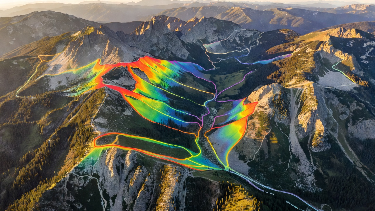
Strava is primarily recognized as a social network for athletes. However, beneath the leaderboards and personal records lies one of the most potent geospatial datasets available to the public. For navigation and route planning, this data translates into unparalleled insight into actual human movement.
The Global Heatmap
The single most valuable navigation tool within Strava is its Global Heatmap. By aggregating millions of GPS tracks uploaded by users, Strava visualizes exactly where people go. On a map, paths glow with intensity based on traffic volume.
Why is this useful for navigation? A topographic map might show a dashed line indicating a trail, but it cannot tell you if that trail is overgrown, washed out, or impassable. If a trail on the map has zero activity on the Heatmap over the last year, you can safely assume it is unmaintained. Conversely, a bright glowing line where no map indicates a trail often reveals a popular, well-trodden local shortcut or unofficial path.
Route Builder and Segments
The desktop route builder leverages this data brilliantly. When you click between two points, you can toggle an option to "Use Popularity." The algorithm will snap your route to the paths most frequently utilized by local runners or cyclists, rather than just the shortest geometric line. This drastically reduces the likelihood of being routed onto dangerous roads or unkempt trails.
Segments—user-defined sections of trail or road—act as micro-checkpoints. They provide historical data on how long a specific climb typically takes, allowing for highly accurate time estimation when planning your own expedition.
Safety and Beacon
From a backcountry safety perspective, Strava offers a feature called Beacon (now available in the free tier for mobile app users). Beacon allows you to share a live tracking link with up to three safety contacts. As long as you have cellular data, your contacts can see your exact location on a map. If you stop moving for an extended period, they have the data needed to alert authorities.
| Feature | Navigation Application |
|---|---|
| Heatmap Layer | Verifying if a mapped trail actually exists and is usable. |
| Popularity Routing | Creating safe itineraries in unfamiliar terrain based on local habits. |
| Beacon | Live location sharing for emergency safety protocols. |
Subscription Considerations
While the basic tracking and social features are free, Strava restricts its advanced route building tools, segment leaderboards, and personal analytics to the paid subscription tier. For serious route planning, the subscription is highly recommended simply to access the desktop route builder mapped against the personal heatmap.
Final Verdict
Strava should not be your primary offline mapping tool—it lacks the deep topographical layers of Gaia and the surface algorithms of Komoot. However, as an ancillary tool used during the planning phase, its heatmap data is absolutely invaluable for confirming route viability before you step foot on the trail.